CCTV News:In the past two days, a wide range of rain, snow and freezing weather has continued in the central and eastern regions of China. On February 21st, the Central Meteorological Observatory issued six warnings for the third consecutive day. On February 21st, the Central Meteorological Observatory issued an orange warning for cold wave, a yellow warning for snowstorm, freezing and fog, and a blue warning for strong wind and strong convective weather.
The Central Meteorological Observatory predicts that on February 21, the precipitation in the central and eastern regions will remain strong, and the boundary between rain and snow will be pressed to the south, and the northern Jiangsu and Anhui provinces and northern Hubei will now be blizzards. On February 22 and February 23, the snowfall in the north decreased, and the rain and snow were mainly concentrated in Jianghuai, Jianghan and Jiangnan.

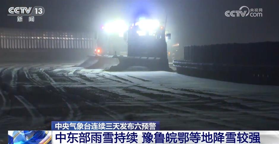
It is expected that rain and snow will continue in the central and eastern regions on February 21st. From 14: 00 on February 21st to 14: 00 on February 22nd, there will be heavy snow in southeastern Shandong, southern Henan, central Anhui, central Jiangsu, most of Hubei, northern Hunan, eastern and northern Chongqing, northeastern Sichuan and eastern Tibet, among which there will be heavy snow in parts of central Anhui, southern and eastern Hubei, northern Hunan and eastern Tibet. The depth of new snow in the above areas is 3 ~ 7 cm, and the local area can reach more than 10 cm; There are freezing rain or ice particles in parts of southern Henan, central and southern Anhui, northern and southwestern Jiangsu, central and eastern Hubei, most of Hunan, northwestern Jiangxi, eastern Guizhou, southeastern Chongqing, etc. The freezing rainfall is 1 ~ 5 mm, and the local area is more than 8 mm. On the morning of February 21st, the Central Meteorological Observatory continued to issue the yellow warning for snowstorm and frozen yellow warning.
In addition, from 14: 00 on February 21st to 14: 00 on February 22nd, there will be 8— Level 10 thunderstorm gale or hail weather; There will be short-term heavy rainfall in parts of southern Anhui, southeastern Hubei, south-central Hunan, north-central and southern Jiangxi, western and northeastern Zhejiang, northeastern Guangxi and northwestern Guangdong, with a maximum hourly rainfall of 20-mdash; 30 mm, the local area can reach more than 40 mm. The Central Meteorological Observatory continued to issue a blue warning of strong convective weather on the morning of February 21st.
The meteorological department reminded that the large-scale rain and snow weather in the central and eastern regions is still continuing. The public should pay attention to the adverse effects on traffic travel caused by road snow and rain and snow weather, such as road icing, slippery road surface and poor visibility, timely pay attention to forecasting and early warning information, arrange travel reasonably, and pay attention to safety.
After 23 days of slow warming in the north, the temperature in the south will drop significantly.
In terms of temperature, monitoring shows that on the morning of February 21st, 6— occurred in northwestern Qinghai, western Inner Mongolia, western Hubei, eastern Guizhou, southern Hunan and northwestern Jiangxi. When the temperature drops at 10℃, the local drop in southern Hunan is 16℃. The Central Meteorological Observatory predicts that on February 21st and 22nd, the cold wave will continue to affect the south of the Yangtze River, South China and the eastern part of Southwest China, and the daily average or minimum temperature will generally drop by 6-mdash. 12℃, in which, the cumulative cooling range in parts of southeastern Guizhou, southern Hunan, northwestern Guangxi and central Jiangxi can reach more than 20℃.
In the next three days, the cold wave will continue to affect China, and it is estimated that the daily average or minimum temperature in most parts of the south will generally drop by 6-mdash; At 12℃, the temperature in the southeast of southwest China, south and central and eastern Jiangnan, and central and northern South China dropped by 12-mdash; 18℃。 Around February 23, the lowest temperature line of 0℃ will be pressed south to the area from southern Jiangsu and Anhui to southern Hunan and southern Guizhou.

During this round of cooling, the highest temperature in many places in the north will reach the lowest point on February 21, and the temperature is 4-mdash lower than normal. At 10℃, the temperature will rise slowly after 23rd, and the cold degree may improve this weekend.
In the south, the temperature in Jianghuai, Jianghan, Jiangnan and other places continued to drop on February 21st and 22nd. For example, the highest temperature in Hefei and Wuhan will hover around the freezing point. With the continuous rain and snow, the wet and cold feeling is particularly obvious. The local public needs to take warm measures and pay attention to the safety of using fire and electricity for indoor heating.

The cooling in South China is lagging behind. On February 21st and 22nd, the highest temperature in many places in Fujian, Guangdong, Guangxi and Hainan may reach about 30℃, and the temperature will drop significantly around the 23rd to 24th, and the temperature will change rapidly. Therefore, the local public should pay attention to the latest forecast and add clothes to keep warm in time.
On the morning of February 20th to 21st, the phase of precipitation enhancement in central and eastern China was complicated.
Meteorological monitoring showed that on February 20, there were medium snow or heavy snow in southwestern Inner Mongolia, northwestern Shaanxi, Shanxi, south-central Hebei, south-central Beijing, southern Tianjin, northern and western Shandong, northern Henan and other places, and heavy snow appeared in parts of central Shanxi, southern Hebei and northern Shandong, with 20-26 mm in Shijiazhuang, Baoding and Zhangzhou, Hebei. Sleet and rain turned to snow in central and eastern Henan, western Shandong, northern Anhui, northern Jiangsu and central Hubei; Zhenjiang and Taizhou in Jiangsu, Chizhou and Xuancheng in Anhui, Jiujiang in Jiangxi and other local rainstorms, with the local area of Chizhou in Anhui being 103mm.
The Central Meteorological Observatory issued six early warnings for three consecutive days.
On February 21st, the Central Meteorological Observatory issued six warnings for the third consecutive day. The Central Meteorological Observatory issued six warnings for the first time at 18: 00 on the 19th, when it issued six warnings: cold wave orange, gale blue, blizzard blue, foggy yellow, sandstorm blue and severe convective weather blue. By 6: 00 a.m. on the 20th, the Central Meteorological Observatory still issued six warnings. Compared with the first six warnings, the blue warning of sandstorm was lifted and the frozen yellow warning was added. At 10 am on the 20th, the Central Meteorological Observatory upgraded the blue warning of blizzard to the yellow warning of blizzard. On February 21st, the Central Meteorological Observatory issued six early warnings for the third consecutive day, and the items and early warning levels were maintained at 10 am on the 20th.